Photographing earth from the stratosphere Part II
How I took images of the earth from 100,000 feet for less than $1,000

Originally published June 24, 2016
This post details the launch of a high-altitude balloon to the earth's stratosphere and the recovery of its payload – GoPro footage. For more background on the project research and build process, read my first post.
I. Launch
After postponing the launch many times over several months due to less than ideal weather conditions and a lot of “life” getting in the way, the day finally arrived.
It was a hot Saturday in June. 90s with a slight breeze. The predicted wind speed at the launch site was 3-5 MPH.
Around 07:30, the launch team left the DC area and traveled south to Charlottesville, VA.
I had called ahead to a local party store to make sure they would have a large enough helium tank available. With a $120 swipe of the card, we rented 120 cubic ft of helium and pointed the car toward the west.
After arriving at the fairly secluded launch site, we started setting up our gear and snapping a few pics of the process.
The total on-site set up time was probably about 45 minutes. With the GoPro recording, I let go of the payload, and the balloon soared into the clouds. As the HAB disappeared from view, we hopped back in the car to return the helium tank.


Over the course of the next two hours, we tracked the HAB’s flight path via the Spot Tracker iPhone app. I had set the Spot to transmit its location every 10 minutes.
The data looked great; the real flight path followed the simulated one almost exactly.
Just under the three hour mark, we received two pings in the same spot.
It appeared the HAB had landed in Blue Ridge, VA – an area northeast of Roanoke.
Success!? We were hopeful but weren’t quite sure yet. After the third ping, the signal was lost. No more transmissions were received. Had someone picked up the payload? Had the tracker malfunctioned? We needed more information.
II. Recovery
After the second ping in the same spot, we switched to the Google Maps satellite view to try and assess the terrain in which the HAB payload had landed. It looked like we lucked out. The payload appeared to have come down on private property directly beside a large woods.
Realizing that we probably wouldn’t arrive at the landing site before dark, the decision was made to drive back to DC and take a long road trip south the next morning.

At 08:00 on Sunday, we embarked on what turned out to be a 500 mile round trip adventure to recover the payload.
Around 13:00, we made our way down a long gravel driveway, deep in the Virginia country-side. A small European-style cottage lay at the end of it. Knock knock. To our surprise, a British woman opened the door. To her surprise, we asked for permission to recover a weather balloon payload on her property. She let out a long laugh. Turned out, this was the second time in recent years she had been visited by a lighter-than-air vehicle; a hot-air balloon had made an emergency landing a little while back.
“Sure, go take a look.” She waved us toward her horse pastures.
Less than ten minutes later, we found it. Right by the woods.

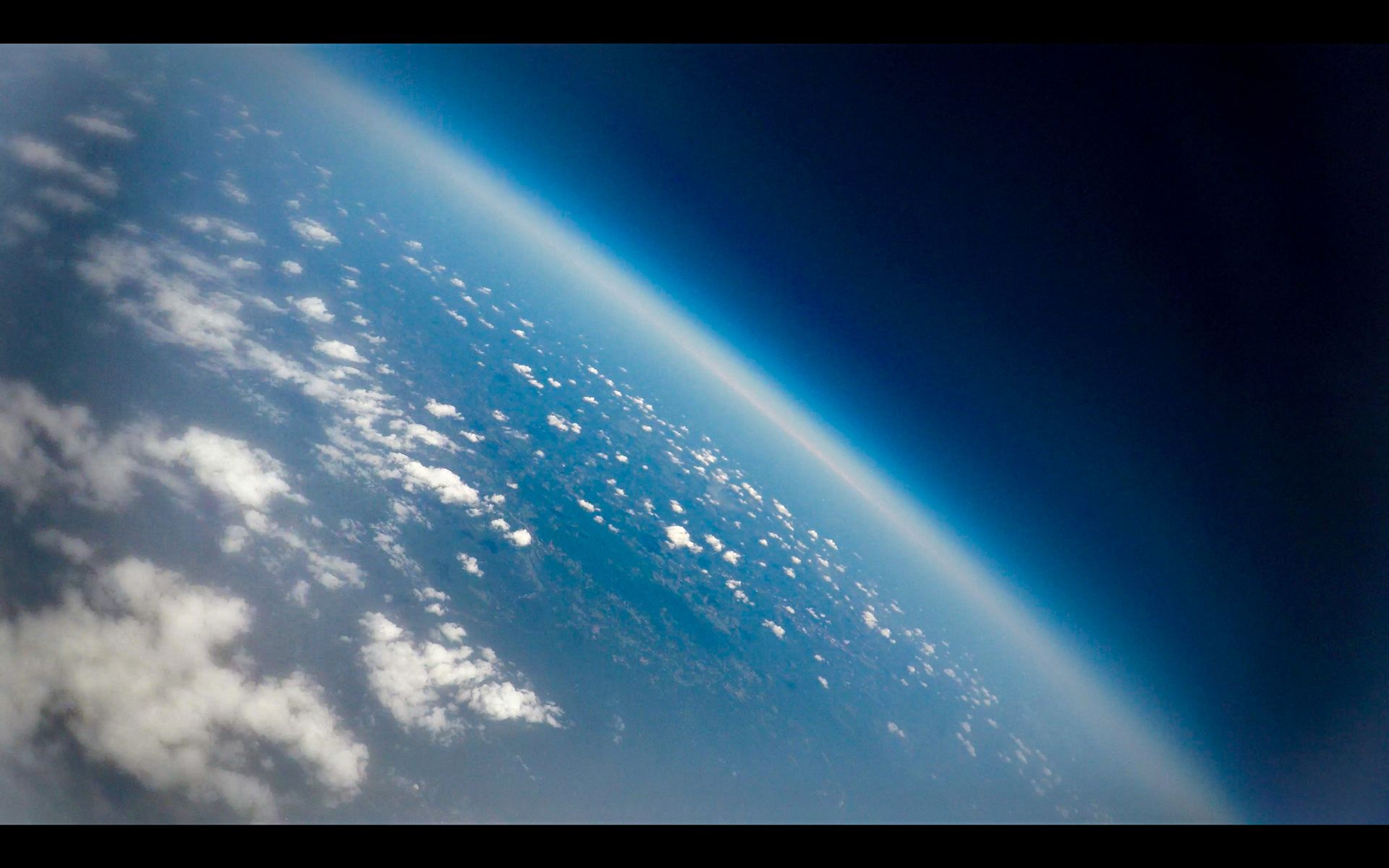
III. Photos from the stratosphere
The following shots are stills taken from 4K footage shot with a GoPro Hero 4. As you might notice from the images, condensation formed inside the GoPro housing. This resulted in the blurring of some of the footage at the higher altitudes. If I attempt this type of mission in the future, I’ll likely attach a digital still camera, in addition to the GoPro. The digital still lens will be less protected, but the condensation shouldn’t affect its shots. Early on during the project, I actually bought a Canon camera and modified its firmware to take pics every 5 seconds until the memory card maxed out. I opted not to include it as part of the first launch, though, because I assumed the probability of recovery was pretty low. Now for the best part…


